The Ultimate Guide to Indoor Navigation
Introduction
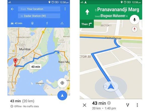
Navigation by today’s standards seems like a simple enough thing. You just turn on the Google Maps application on your phone and just type in where you want to go. The amazing thing about it is that the technological advancements that took place over the last decade that allows us to do this. Gone are the days when you had to refer to a map to find out where you were and where you were going or ask some shady stranger the whereabouts and ‘whatabouts’ of any place, all thanks to some soviet artillery firing two missiles over the Sea of Japan. And thanks to this, now you have no problem locating the nearest point of interest in an unfamiliar territory or leave the car to drive on its own. This really is one of the pinnacles of modern day technological achievement that has enhanced the way we travel and find our way through the maze of concrete jungle up to the peaks of the Andes. Now imagine going a step further and taking this outdoor thing, indoors. Yes it’s possible and already in the works. Let’s discuss this in detail.
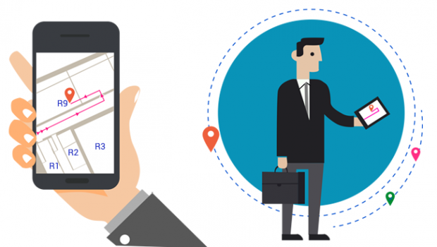
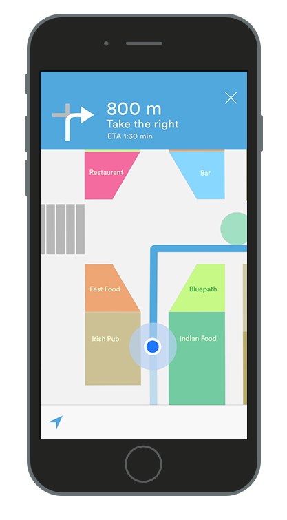
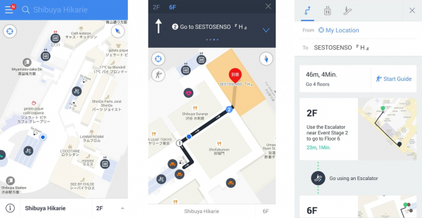
Indoor navigation is indeed a real thing, however unproven. Not much far from now you’ll be able to navigate your way around big establishments and large shopping malls through the mall maps system without the frustration of going round in circles. Even Google has a full-fledged feature set for indoor navigation with the Google Maps application. So, you know that Indoor navigation companies like JibeStream are indeed making it a reality in today’s tech world.
The Works
By this point you might be wondering, how it’s going to work. And well that’s why I pointed out earlier that this is an unproven bit of technology on a large scale. The reason that I said it is because unlike GPS that provides coordinates of the earth to aid navigation and uses satellites to map out the layout of the terrain and then render all data in the form of a virtual map of the place, the indoors of an establishment are more complex to map out and render because they often consist of multiple levels and GPS cannot be used to achieve this. Apart from that, there are actually quite a few reasons why indoor mapping of establishments is difficult, some of which I’ve mentioned below:
- Unavailability of structural data of the establishment.
- Mapping out buildings via man power is a laborious and expensive process.
- In many establishments, there are restricted areas which are forbidden for the general public to enter.
- Several countries are not developed enough to provide information on their establishments.
- Organisations unwilling to provide the layout of the premises for public viewing on account of security.
Check out why data security is better than ever, here.
Fortunately though, there is a workaround to this problem which aims to mitigate the abovementioned problems, or most of it anyway.
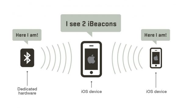
Enter IPS (Indoor positioning system). Many companies are now working to provide a way to make this happen. Mobile SoC manufacturer Broadcom has a line of integrated indoor navigation chips dedicated for mobile devices. Even Nokia has their own system of indoor navigation, albeit they provide 3D models of buildings instead of 2D maps. They will apparently use Bluetooth tracking to render images of the building but its success is yet to be determined as it requires installation of a lot of Bluetooth beacons. Apple Inc. also has something similar that works on Bluetooth beacons called the ‘iBeacon’.
Read more about Bluetooth beacons HERE.
Another company named ‘Sensewhere’ is taking a whole different approach to this problem. What Sensewhere does is that it takes into account multiple radio signals rather than a single source and creates an ‘Electronic Map’ of the establishment to guide the customer around the place. What’s more is that they claim that due to the immense collection of data of the place, the system automatically improves overtime and updates itself should the layout of the building change. It also takes into account data mining, through which both the customer and the service provider can keep track of certain aspects of their businesses like time spent by the customer in a particular place. Their website has a detailed video of how the whole system works and I highly suggest you to check it out for further information on the technology.
For now there are limited means to achieve total structural mapping for establishments and even though Wi-Fi triangulation did provide a solution for some time, it wasn’t all that reliable as Wi-Fi signals travel limited distances and unless the signal is being repeated, there is considerable amount of signal loss and setting it up is a difficult process. Wi-Fi triangulation was originally Google’s own method. Basically what it did was that it tracked you via the Wi-Fi signals. It knew where the Wi-Fi hotspots in the building were and through signal strength triangulation, it worked out roughly where you were. But as mentioned, none of the mentioned methods were reliable enough as setting up multiple Bluetooth beacons can be expensive and Wi-Fi signals degrade a lot and are used for more than one purpose which can cause issues with the quality of tracking and more so, driver conflicts.
New Developments in the Field
So what’s the latest development in indoor navigation you might ask? Again, as with many things, Google has your answer.
If you are an avid follower of latest technological trends, then chances are that you might have heard about Google’s own Project Tango.
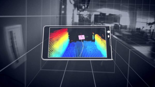
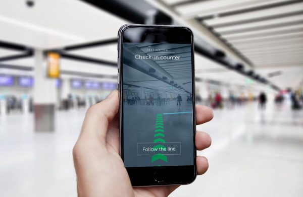
So Tango is basically an augmented reality computing platform developed by Google that uses the computer’s vision to enable mobile devices to detect their position while relating to the world around them. The great thing about project tango is that it doesn’t rely on any external input for data such as Bluetooth and Wi-Fi to assist indoor navigation. But indoor navigation is only a small part of the whole Tango Project. Developers can further use it to map 3D spaces, measure physical space and recognise its surroundings. You can check out a demo of the Project Tango in this video. However Google hasn’t stopped at that. Recently they announced a new extension to their Tango project called to the ‘VPS or Visual Positioning Service’. VPS is supposed to be a kind of GPS for indoors but instead of fetching data from satellites, it will triangulate the position based on distinct visual features in the environment. The VPS was announced in Google’s I/O 2017. Here’s the announcement video for the VPS. If VPS were to come into full effect, then it could be the pièce de résistance of all the current indoor navigation technologies.
Google also allows you to be a part of the Indoor Maps Plan by allowing you to upload your business’s floor plan and in turn creating a virtual map of your building.
Check out how big data impacts small businesses.
The Uses of Indoor Navigation Tech
The way we navigate around big establishments today is according to visual cues such as signboards and buildings being split into zones such as Clothing, Grocery, Hardware and so on. And this is okay for the most part because it works flawlessly. Generally speaking categorising things makes us find them faster and saves time. So why then we even need navigation for indoors?
Here are a bunch of reasons about why it is better over traditional means:
- Indoor navigation tech will allow you to see exactly where you are in the grid of the establishment without having to find signboards.
- It will allow you to bookmark zones that you visit frequently via the shortest possible route.
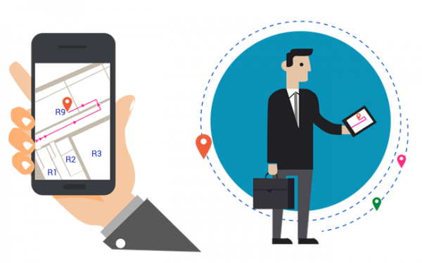
- With recent developments, you will be able to locate an exact item that you are looking for among the sea of items in places like Shopping Malls.
- In case you don’t know the place well enough, indoor navigation tech can help you navigate the place with ease.
- With virtual maps of the place, you don’t have to walk and search for the next point of interest. You can rather search for the location and the app will instantly give you information about your particular query so you can arrive there faster by setting a predefined route.
- Emergency services like the paramedic and rescue teams could potentially arrive at the scene faster in cases where the building grid is complex.
The abovementioned points are just some of the things possible with indoor navigation tech to assist the consumer. Of course the applications of this tech aren’t just limited to these but overall the skyscraper is the limit. Pun Intended.
But can this same technology benefit the businesses you might wonder and again the answer is indeed a positive one. So let’s look at some of them:
- Boosting Productivity: In factories and large scale organisations, indoor navigation tech can boost productivity by accurately monitoring the workforce and optimising their placement and work schedule. As an added bonus, it can track products too so there isn’t loss or misplacement of said items. This eliminates the need for multiple supervisors and legwork of said individuals as a central command centre can be setup to run the workforce.
- Boosting Security: Companies or Organisations that work in the Million/Billion dollar category can effectively use this to track visitors and company individuals and accurately pinpoint their position within the premises, so they can’t enter restricted areas or areas where they are not authorised to be in.
- Theft Prevention: In small scale businesses, Indoor navigation tech can be used to monitor products and potentially track them. Thereby eliminating the possibility of unwanted theft of items.
- Customised Experience: Another advantage to small businesses like cafés and restaurants is that it can used to collect customer experience data and this in turn could potentially allow the place to provide tailored experiences for their customers like discounts and coupons.
Data security for small businesses.
- Easy navigation: This applies for businesses as well. Data collected from multiple sources can be analysed and then engineered to set up the business layouts so that the customer and the workforce has an easy time navigating the place and items of the highest priority are within short reach.
- Beneficial to short term instalments: Occasions like trade fairs, trade shows, exhibitions are often held indoors and because of their hasty placement of stalls, navigating the show becomes confusing. Indoor navigation can mitigate this by creating a pre formed layout of the establishment and stall placement, so that the customer can find points of interest faster in a crowded environment.
Should You Outsource Your Data Entry?
Conclusion
The future for indoor navigation if anything, looks even brighter. With AR and IOT playing a major role in making this happen, we could soon be changing the way that we interact with the world around us. The prospect of indoor navigation is still sometime away though because technologically it is a very big feat to pull off. Indoor navigation is always more complex than outdoor navigation because each building has its own unique layout and its own unique placement of services and as such the amounts of data required is also much larger than standard GPS maps. But it’s just another hurdle in a sea of awesomeness and it isn’t something that can’t be dealt with. So Indoor Navigation FTW!

