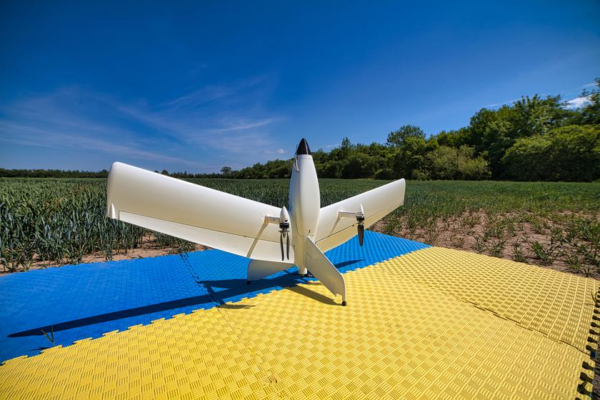
In September, the Commercial UAV Expo 2022 exhibition was held in Las Vegas. At the exhibition, the Ukrainian company Culver Aviation presented the innovative Menatir system. This is a high-tech unmanned air monitoring system. It is reported by the National Industrial Portal with reference to the source Korrespondent.net.
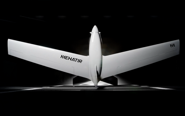
It is indicated that the system is fully automated. The drone can travel up to 45 kilometers to a target and return to the base on a single battery charge. Uses drones with vertical takeoff and landing.
The system includes one to six drones. Any drone can be equipped with one of the following payload types:
- Digital camera. For mapping, orthophoto planning, and creation of digital terrain models and infrastructure objects.
- Eco-sensor. For monitoring air quality at different altitudes.
- Multispectral camera. For monitoring agricultural land, green areas, and water bodies.
- Video camera equipped with a thermal imaging camera. For real-time video surveillance at any time of the day and in difficult weather conditions with the ability to automatically detect objects using artificial intelligence elements.
- Video camera. For real-time video surveillance with the ability to automatically detect objects using artificial intelligence elements.
- Various specialized equipment corresponding to the declared weight and dimensions. To meet any customer needs, Menatir UAV can carry any equipment with dimensions up to 220x120x75 mm and weight up to 1 kg.
MENATIR’s high-resolution cameras, thermal and video cameras and other types of payloads can operate effectively around the clock. The decision support system with elements of artificial intelligence processes video and automatically detects fire, smoke, spills.
The Menatir system is indispensable for large companies. How can the system facilitate the work of enterprises?
The system provides control over the cultivation of crops for agricultural enterprises, calculates the volume of extracted minerals for the mining industry, conducts inspections of industrial buildings and roofs, monitors the condition of pipelines, process lines and power line poles and much more.
Areas of application of Menatir for business:
- agricultural sector
- mining industry
- business parks
- infrastructure facilities.
The MENATIR system is effective on a large city scale.
It performs many tasks: property survey, cadastral survey, energy efficiency audit, traffic monitoring, analysis of road or railway infrastructure quality, analysis of water level in rivers, air quality analysis.
Areas of application of Menatir for government:
- administrations of cities, regions and countries;
- emergency services;
- fire stations;
- road services;
- utilities and infrastructure services;
- environmental inspections;
- law enforcement agencies;
- optimization of municipal expenditures.
One container with Menatir UAV can provide round-the-clock surveillance of the required areas and air quality monitoring, which significantly increases the efficiency of urban surveillance systems. Aerial imagery makes it possible:
- Detection of landscape fires at early stages, which minimizes the negative impact on the environment and reduces the cost of fire damage restoration.
- Aerial monitoring of the river basin, which provides control over aquatic vegetation, timely warning of industrial waste discharge and other illegal actions.
- Inspection of the city’s road infrastructure to detect road damage, assist in planning and preparation of construction, road repairs and monitoring of construction progress.
- Inspection of the city’s utility infrastructure for pipeline defects, leaks and corrosion, checking the integrity of power lines and insulation, thus minimizing maintenance costs.
Menatir system can be controlled from anywhere in the world with only one operator needed.
Features of the network air monitoring system “Menatir”
- Real-time video surveillance.
- Air quality monitoring.
- Thermal imaging monitoring.
- Multispectral mapping.
- Orthophotography and 3D mapping.
Conclusion on the product
The Menatir network consists of a set of base stations in the format of regular 20-foot containers that hold unmanned aerial devices. The containers protect the drones and allow them to launch, land, complete a task, recharge, and broadcast the accumulated data. Everything is done automatically without exception.